SMART Compliance

Summary of the Module

The TG20:21 wind factor module is an enhanced version of the wind map from the TG20:21 eGuide which generates a calculation report including justification and explanations for the wind calculation. The software produces the refined wind factor calculation based on the CADS VelVenti software.

The automated calculation of the software enables the rapid determination of peak wind speeds and pressure in accordance with the current design standards. The fundamental basic wind velocity, site altitude and details of the surrounding topography are determined automatically. These include the distance to the sea, whether in town terrain and, if so, the distance inside.

Display Panel Options

Map

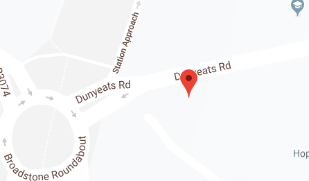
The software module begins with a map view to allow you to input the site location, which defines the potential wind loading on the structure.

You can input the address by:

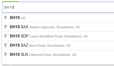
  • Using the Google Places lookup service, either by postcode, partial address or company name. The search is filtered to only include addresses in the UK and Ireland. This allows detailed searches on company names and partial street addresses to work well.
  • Moving the site marker with the mouse to the precise site location on the map.

In either case, the site address (in the right-hand panel) is populated automatically from Google Maps services. This address can be manually overwritten if required.

3D model

A 3D preview is displayed for the site, which can be zoomed, panned or rotated. A satellite display is shown by default. Alternatively, the display can be switched to show a 3D road map view with street names and building outlines.

In both cases, the map display can be zoomed in or out to show one of five detail levels. This allows local streets and buildings to be viewed, or a broader view of the surrounding topography. Holding down the left mouse button will allow you to rotate the view. The mouse scroll can be used to zoom in or out. Holding the right mouse button will allow you to pan the view.

Results graphs

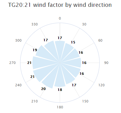
The Results graphs tab shows a wind rose, with the calculated TG20:21 wind factor in the 12 wind sectors considered by the calculation. A tooltip is provided that shows the wind direction in degrees and the corresponding wind factor. The wind rose segments are coloured corresponding with the TG20:21 wind factor classifications. Please note that indicated degree directions are relative to North 0°.

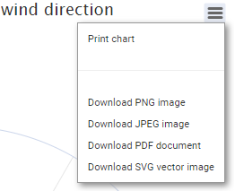
You can print/save this graph by selecting the corresponding option from the 3-line button.

Calculation report

The Calculation report tab displays the report. The report can be switched between the three detail levels:

  • Summary report – this includes tabular presentation of the inputs and the outcome of the calculation;
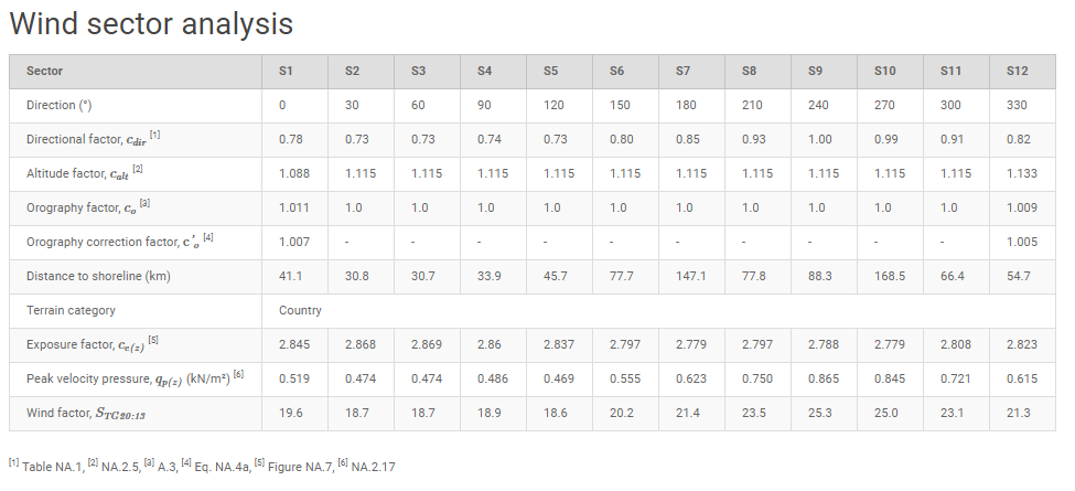
  • Calculations report – this includes the presentation of the inputs used in the calculation, wind sector analysis table and a wind rose graph. The table present the calculated values for each of the sectors presented in the wind rose graph;
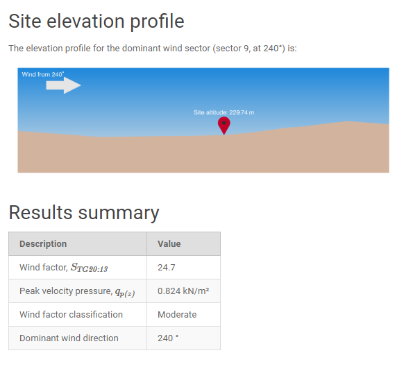
  • Detailed report – this is a step by step presentation of the wind factor calculations for the dominant wind sector.

Irrespective of the output calculation level, the Calculation report will always contain a tabular output of all the inputs used in the calculations.

You can export the calculation report either as a .docx or as .pdf using the dedicated icons at the top right corner, next to the calculate button.

Input Panel Options

Site details:

  • Site details – The site address is populated automatically from Google Maps services once the site location has been established on the map. This address can be manually overwritten if required, however, please note that the location of the site on the map will not change.
  • Scaffold base level – The vertical distance between the ground level and the base of the scaffold, in metres, for use when the scaffold is supported on a building or other structure.
  • Scaffold height – The maximum height of the scaffold (in metres).

Wind exposure:

  • Consider sheltering from nearby buildings – Select this option to reduce the wind exposure by considering the sheltering effects of nearby buildings. The sheltering effect is only applicable to wind sectors that are calculated as being within town terrain.
  • Design life – Select if the structure is a temporary structure (≤ 2 years) or if it is a long- standing/permanent structure.
  • Standing during – Select the spring and summer option to reduce the wind exposure for scaffolds or temporary structures standing only between April and September. This option is applicable only if the design life is set as ≤ 2 years.

Display:

  • Show wind velocity map overlay – Select this option to display the wind speed contours superimposed on the map, where available. The overlay displayed corresponds to Figure 4.1 of the TG20:21 Design Guide, which displays the basic wind speed (m/s) before the altitude, orography and exposure coefficients are applied to calculate the site wind factor.